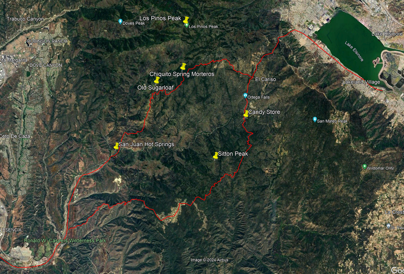
From Acjachema to Pājaktse - Trails Over the Santa Ana Mountains from San Juan Capistrano to Lake Elsinore, c. 1769-1845
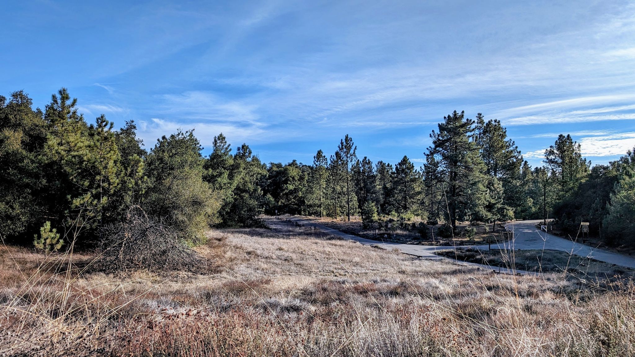
High in the Santa Ana Mountains are relatively flat areas with meadows with the Spanish name “potreros.” Pictured here is the Potrero los Pinos. It's quite something to consider this is a natural part of Orange County, a place far better known for its beaches and urban sprawl.
From Acjachema to Pājaktse
Trails Over the Santa Ana Mountains from San Juan Capistrano to Lake Elsinore, c. 1769-1845
The Santa Ana Mountains form an ever present background in the lives of the people of Orange County. This is somewhat ironic given the stark contrast between the cities and housing tracts below and the mountains’ untouched appearance above, broken only by power lines, truck roads, and radio antennas. Their natural quality serves to remind us that the rest of the county was once a more natural place. The mountains preserve the character of history before the urban sprawl. Perhaps the mountains’ ruggedness, or something in the name “Old Saddleback,” evokes the distant past. The mountains feel like a setting where great stories took place.
This early history, however, is generally as shrouded in mystery as the appearance of Old Saddleback on a gloomy day. We do know that sacred stories of the Tongva, Acjachemen, and Payómkawichum peoples occurred in and around the mountains. The people themselves lived in the canyons, traveled the ridge lines, hunted game, and gathered and processed the acorns from the oaks. Following Spanish colonization and the establishment of Mission San Juan Capistrano in 1776, the mountains started to be explored and utilized in new ways. Missionaries and leather-jacket soldiers made their way into the canyons and along Indigenous trails. Soon thereafter, famed ranchero families such as the Yorbas, Serranos, Peraltas, Argüellos, and Forsters did the same.
But what we really know of the mountains becomes a part of our shared history after they came under the control of the United States in 1848. Historian Terry Stephenson told us much of the story from there in his books Caminos Viejos and Shadows of Old Saddleback. He wrote of the first recorded ascent of Old Saddleback by Major Horace Bell and the Los Angeles Rangers’ while in pursuit of horse thieves 1853. He told us of the desperate leap off the top of Flores Peak by Juan Flores and two of his fellow outlaws while evading a pursuing posse in 1857. He introduced us to the stories of many of the canyons, their surveys, mines, homesteaders, beekeepers, and bears. He inspired others such as Jim Sleeper and Phil Brigandi to expand on his research, providing us wonderfully detailed histories of grizzly bears and “boom” towns.
Yet the mountains’ mysterious qualities endure. Perhaps this is in part because there is a conspicuous gap in their history during the mission and rancho periods (1769-1848). Historians have been unable to say much more than we know missionaries, soldiers, and rancheros explored the mountains. Exactly where they went and what they did, however, is still largely unknown. This early history of the mountains is an important source of their allure. The purpose of this article is to uncover some of this history by investigating how indigenous trail networks connecting Mission San Juan Capistrano to the Lake Elsinore area (today connected by the Ortega Highway) were utilized and evolved during the Spanish and Mexican eras.
An Important Acjachemen Trail
In the first half of the twentieth century anthropologist John Peabody Harrington interviewed locals in the Mission San Juan Capistrano area who told of an important Acjachemen/Payómkawichum path over the mountains. This route connected the coast in the Dana Point area to San Juan Hot Springs, which are located towards the mouth of Hot Springs Canyon close to its confluence with San Juan Canyon. From there the trail climbed over the mountains to Lake Elsinore. An Acjachemen informant, José Gracia Cruz (better known as Acú), was Harrington’s primary source for the Acjachemen place names along the route. Ranchero Marcos Forster, son of John (Juan) Forster, helped Harrington sketch a map of its path.
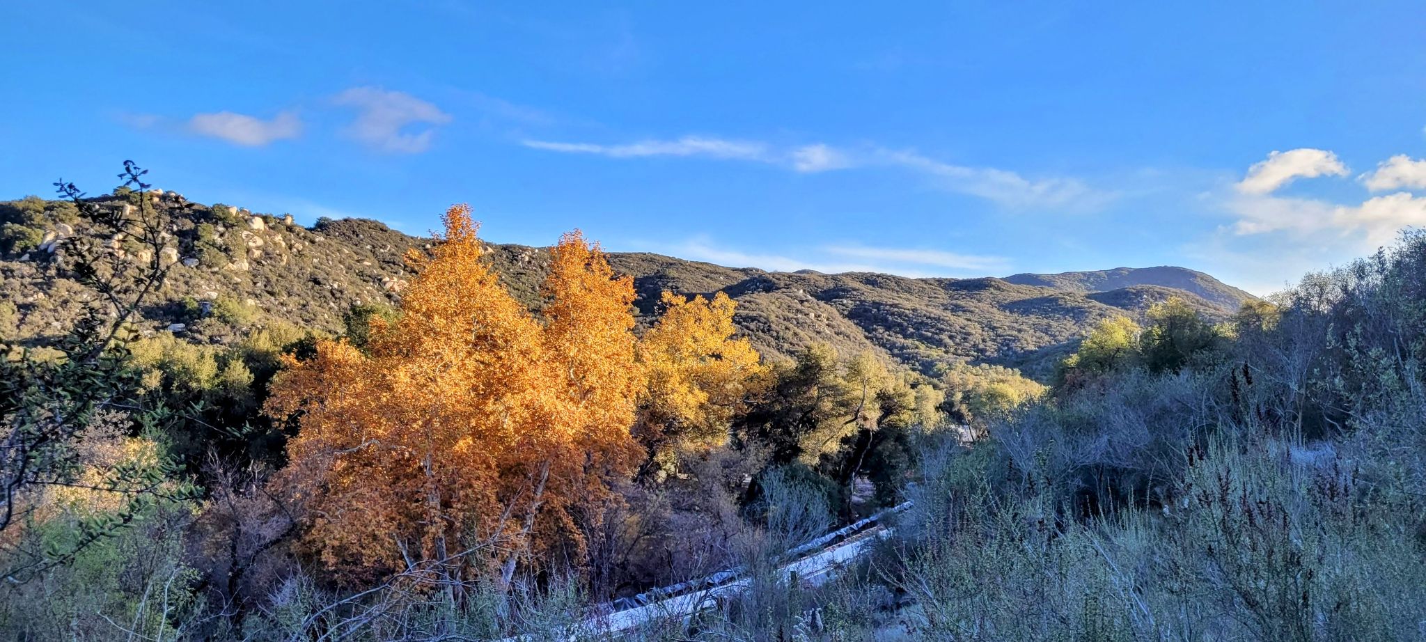
Starting from the coast, Forster indicated that the trail generally stuck to the canyon bottom to San Juan Hot Springs, which Acú said were called “‘Atéyvaya” by the Acjachemen people, and served as an important stop along the route. The springs were utilized by the people for many of the same reasons that made them popular as a resort in the late-nineteenth and early-twentieth centuries. Their warm waters were comfortable to bathe in and considered to be restorative to both body and mind. They likely had spiritual significance as well.
The trail then climbed a ridge about three quarters of a mile above the hot springs, probably up the same ridge followed by today’s San Juan Trail, albeit now with an easier grade along switchbacks constructed by the Forest Service. The Acjachemen trail apparently stuck to the ridge line between Hot Springs Canyon to the north and San Juan Canyon to the south before rounding Sugarloaf Peak and dropping into the meadows and spring of Chiquito Basin at the edge of the Potrero Los Piños.
Boulders in the Chiquito Basin area contain deep mortars, which are holes ground into rock by indigenous peoples primarily used to crush acorns into meal. The workers would use a mano, or pounding rock, to crush the raw acorn into a small processing hole in the rock and remove the husk. They’d then both pound and crush the meal into a deeper mortar and collect the meal in a basket or other receptacle. The meal was often soaked in water for some time to remove unsavory tannins prior to being made into food using a variety of recipes and methods, often mixing it with some water or even roasting it with hot stones in a basket. Acú said that the mortars were called “notro’pa” and the mano was called a “noyóxxala.” The processing of acorns was generally done by women, indicating that the Chiquito Basin was at the very least seasonally occupied within a village territory, not simply a stop along the trail. One can now imagine women and children gathering acorns from the abundant oaks in the area in baskets and taking them to the no-tro’-pa. Afterward the word “poya’,” meaning “pound it up!” could be heard echoing in the trees as the acorns were processed.
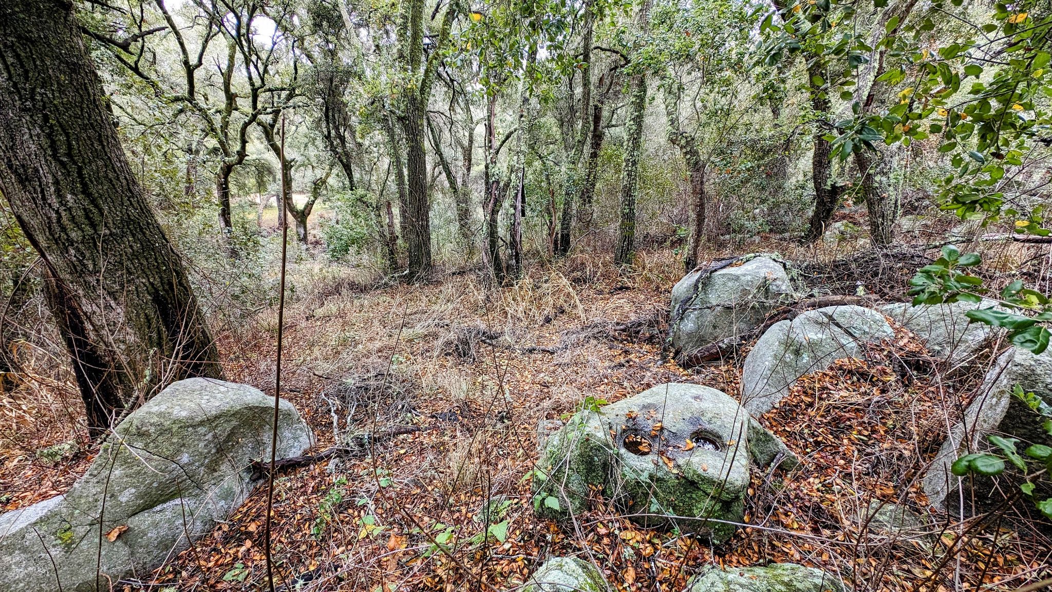
Near Chiquito Spring are mortars (no-tro’-pa - pictured at the lower-right) where acorns were once processed by Indigenous peoples. This site was along a primary route of travel over the Santa Ana Mountains that connected the San Juan Capistrano and Lake Elsinore regions.
From Chiquito Basin the Potrero Los Piños climbs northeastward to the highest of its meadows near today’s Blue Jay Campground, which are surrounded by both oaks and the pines that give the potrero its name. Near this northeastern end is Los Pinos Spring, another dependable water source reaching the surface from deep within Los Pinos Ridge. Acú told Harrington that the potrero and the nearby Los Pinos Peak were called “Taráxxa” and that he would look at it from below to see if it was covered in fog, which helped him and the Acjachemen predict the weather. While the significance of the place name Taráxxa has yet to be determined (although it may mean something like "place of the flint"), it was apparently a place of great importance and possibly also referred to the village site in one of the meadows of Chiquito Basin. Acú said the mountain ridge of Taráxxa was “like a God” to the Acjachemen people.
The trail then headed down from the Potrero Los Pinos to the Potrero El Cariso where it joined another trail coming up from Morrell and Decker Canyons that will be discussed later in this article. An archaeological site in the Potrero El Cariso region may have marked a trail junction. From there, the route followed close to today’s Ortega Highway, passing the El Cariso Campground and then likely down the El Cariso Trail and Forest Route 6SO6 (the El Cariso Truck Trail) to the Lake Elsinore region. Acú said that Lake Elsinore area was called “Pājaktse,” but it was much smaller at the time of Spanish colonization in the eighteenth century. One traveler in 1810 apparently described it as “little more than a swamp about a mile long.”
A series of meadows surrounded by oaks stretch from Chiquito Basin to the southwest to the area around Blue Jay Campground along Main Divide Road above Ortega Highway. These meadows are collectively known as the Potrero Los Pinos.
The swampy area that was then Lake Elsinore was of particular importance to the Acjachemen people. It was there that the first people were formed from the mud by the important god Chinigchinich (pronounced chin-ichsh-nichsh). The sacredness of the site was shared by peoples throughout the area, making it an important destination with trails leading to it from all directions.
The route from San Juan Hot Springs to Lake Elsinore was only one of numerous trails that made their way over and throughout the mountains. Forster told Harrington that another trail left the Lake Elsinore area and headed south into the mountain country through the Santa Rosa Plateau and Rancho de Luz. Forster said from there it went west to “La Paz (a canyon beyond Talega Canyon from here [San Juan Capistrano],” possibly referring to today’s San Onofre Canyon in Camp Pendleton along a route passing south of the Santa Margarita Mountains, which are a high ridge in the southern Santa Ana Mountains. From there the trail climbed a low divide and dropped into San Mateo Canyon, which it followed all the way to the village of Pange located near the Pacific Ocean.
This southern route was the same followed in 1769 by the Portolá Expedition, the first overland Spanish expedition through today’s California. The expedition passed through San Onofre Canyon and camped in San Mateo Canyon within today’s Camp Pendleton near a small village, possibly Zoucche. There the expedition’s missionaries, Fathers Juan Crespí and Francisco Gómez, baptized two Acjachemen babies who were sick and/or possibly injured and apparently in danger of dying. These were the first two baptisms in today’s state of California. For more than a decade thereafter the route followed by the expedition became the primary pathway utilized by the Spanish colonists traveling between San Diego and points north. Following the permanent establishment of Mission San Juan Capistrano in 1776, the colonists integrated themselves into the extensive network of trails created by indigenous peoples that connected regions throughout California and the Southwest. It wasn’t long until they started making their way into the Santa Ana Mountains.
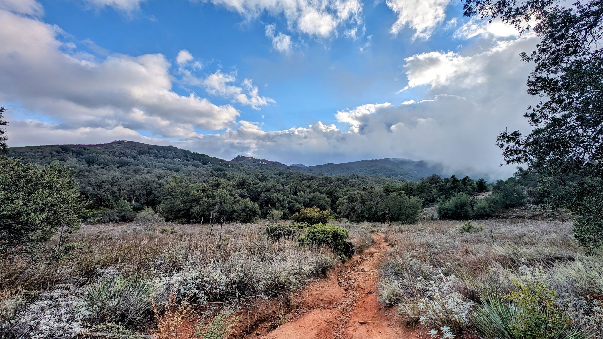
Ortega Highway passes through the middle of the Potrero El Cariso. Above it is Los Pinos Ridge and peak, pictured here with snow. This region was known as Taráxxa among the Acjachemen people.
San Juan Hot Springs
Missions were far more than a church, houses for the missionaries and soldiers, warehouses, and other outbuildings. Their control extended over vast territories that stretched from the coast to the interior valleys and mountains. At its greatest extent, Mission San Juan Capistrano had dominion over the lands stretching from about the Santa Ana River to the north, south along the coast to San Mateo Canyon, and inland to the Santa Ana Mountains. The mission extended into these areas over a period of decades. In its beginning in the 1770s and 1780s the mission was centered in lower San Juan Canyon and slowly expanded into lower Trabuco Canyon to make use of its pasture and break new ground for agricultural developments. By the late 1780s it extended northward into the foothills with the establishment of the Trabuco Rancho (in today’s O’Neill Regional Park), which was probably used as sheep pasture for wool production. Since sheep need less water than cattle, they were more appropriate to pasture in the relatively dry region along the Trabuco Mesa. Further incursions into the foothills and mountains were motivated by a variety of reasons including the search for water, new mission sites, and dependable pasture.
The need for dependable water was a constant concern. As more Acjachemen from the surrounding villages were baptized and started living at the mission, the missionaries and soldiers were constantly inquiring where they might find freshwater sources. The Acjachemen would pass along knowledge of watering places at their own discretion, which would cause the military leadership to organize exploration parties to search for them. The location of one such spring was made known to the Governor of California, Pedro Fages, in 1790. In August of that year, Fages ordered Corporal Juan María Olivera and three soldiers, including Juan María Ruiz, to search for the spring somewhere in San Juan Canyon towards the mountains. In regard to the search, the commander of the San Diego Presidio, José de Zúñiga, wrote to Fages to inform him that the original order would take the soldiers beyond “the last Indian village of the three that we encounter in the canyon,” which he reported as dangerous because “our relationship with the gentiles [unbaptized people] extends only to the last village in San Juan Canyon where the mountains cut us off.” The known villages in San Juan Canyon were Sagivit (located near the intersection of Antonio Parkway and Ortega Highway) and Piwiva (located near the confluence of Gobernadora and San Juan Canyons). This makes the last of the three villages that Zúñiga referred to as either Piwiva (if there was another village down canyon in the vicinity of Sagivit) or another unnamed village up canyon, possibly near Ronald W. Caspers Wilderness Park.
In any case, the implication may be that the spring they were searching for was today’s San Juan Hot Springs. As mentioned previously, these springs were a dependable source of water in the region and their later importance would make them a strange omission in Zúñiga’s letter to Fages had they already been aware of them. Furthermore, the San Juan Hot Springs must have been discovered by the Spanish sometime between August of 1790 and 1792 because a Spanish traveler, José Longinos Martinez, visited them in June of 1792. He reported that they were at the “parallel [latitude] of Mission San Juan Capistrano, on the slope of a hill towards the mountains, among several rancherías of gentiles, there are ten or twelve of them at 65 ํ Réaumur.” He added that all of the springs “together yield about two tiles of water, more than an ox of it, charged with calcareous selenite and gas.” The timing of Martinez’ visit coincides with Fages’ order to search for a spring of water two years before, suggesting a connection between the two events.
Just east of the San Juan Hot Springs area San Juan Canyon narrows and the mountains rise dramatically. While the Spanish likely became acquainted with the well-known Acjachemen trail over the mountains from the hot springs by the mid-1790s, the rough terrain likely prevented them from traveling over it without a compelling reason to do so. It wasn’t long until one arose.
Two indigenous trails crossed the Santa Ana Mountains from Mission San Juan Capistrano to the Lake Elsinore region. One passed to the north of today’s Ortega Highway, roughly following today’s San Juan Trail. Another passed to the south of today’s Ortega Highway, passing just south of Sitton Peak and the Ortega Oaks Candy Store. The two trails met at the Potrero El Cariso before dropping into Temescal Valley near today’s Lake Elsinore.
The First Recorded Spanish Traverse of the Santa Ana Mountains
The Franciscan missionaries in California had plans to continue to found new missions in the gaps between the existing missions. They also planned a second chain of missions up and down the state further inland. A large gap existed between Missions San Diego and San Juan Capistrano, requiring colonists to spend a night in camp when traveling between the two missions. A survey for mission sites in today’s northern San Diego County was conducted by Ensign Juan Pablo Grijalva of the San Diego Presidio and Father Juan Mariner of Mission San Diego in 1795. They concluded that the best location for a mission was today’s Pala. The site, however, worried the Franciscan President of the missions, Father Fermín de Lasuén, because Pala was about fifteen miles from the so-called Camino Real, which was the primary pathway connecting San Diego to Mission San Juan Capistrano. Such a distance would make travel to the mission inconvenient, prompting Lasuén to conclude that another survey was needed. In September of 1797 he arranged for seven soldiers, including journalist Pedro Lisalde, five Indians, and Father Juan Norberto de Santiago of Mission San Juan Capistrano to conduct a new survey. Lasuén also kept a journal of their travels.
Acjachemen informants had apparently told the missionaries and/or soldiers that there was a route over the Santa Ana Mountains that accessed the Temescal Valley, Temecula, and Pala. Since Lasuén wanted to determine if the region was reasonably accessible via the existing indigenous trade routes he decided to follow it.
The exploratory party left from Mission San Juan Capistrano at daybreak, about 6:45 AM, on October 2. The soldier Lisalde recorded that they left at 6:00 in the morning, suggesting that he used 6:00 as a mark for sunrise even though the actual time was 6:45. Lasuén, on the other hand, may have had access to a watch or some way to mark time because he records more precise times of day in his journal.
In any case, Lasuén recorded that they “passed through the arroyo where the mission keeps a flock of sheep [possibly Horno Canyon], proceeded to the canyon and ranch of the Christians [Mission Vieja in San Juan Canyon] and followed it eastward to its end.” Neither Lasuén nor the soldier Lisalde mention in their respective journals the San Juan Hot Springs, suggesting that they did not take the well-known trail over the mountains north of San Juan Canyon, starting above the springs and heading eastward to the Los Pinos Potrero. Lasuén does, however, write that they “began to climb and descend very high slopes, slopes with such a bad surface that it is possible that they would be inaccessible in rainy weather, as they are of adobe soil.” It seems the party was following a ridge south of San Juan Canyon, possibly through Lucas Canyon since Lasuén doesn’t mention the potreros in today’s Rancho Carrillo Community. From the top of the canyon their trail likely followed today’s Verdugo Trail, passing south of Sitton Peak on its way to Four Corners and Pigeon Spring. Of this section of their route Lasuén remarked that “the only passage through them [the mountains] is along their highest points, or through narrow passes that are steep and very precipitous.” Their path was certainly more extreme than the usual roads traveled by the colonists between missions and presidios.
Both Lasuén and Lisalde wrote that the party stopped to eat lunch. Lisalde simply reported that “at about noon we passed through the place of ‘las Animas’ [‘the Spirits’] and at about 2:00 PM we left.” Lasuén wrote that “around half past one in the afternoon we reached a little canyon that had a few alders, and three little springs which were barely sufficient to water the horses” adding that “there we took our meal.” The most interesting remark made by Lasuén was that the canyon “had a few alders.” Since oaks are common along the route he seems to have avoided noting them in his journal. Alders, however, are limited to canyon bottoms where there tends to be a more consistent flow of water throughout the year. If the trail was indeed descending from today’s Four Corners and Pigeon Spring, it may have dropped into the upper reaches of San Juan Canyon at or near the confluence of today’s Morrell and Decker Canyons (in the vicinity of today’s Ortega Oaks 74 Candy Store and Goods). This area has alders and could accurately be described as a “little canyon” compared to the larger watersheds traversed earlier in the day. The five Acjachemen guides knew where there was dependable water in the mountains so late into the season and intentionally led them to the spot. While Lasuén described “three little springs,” they were probably three pools of water in the canyon bottoms.
High in the Santa Ana Mountains San Juan Canyon has numerous small tributaries, the largest of which have names. Near the confluence of two of these tributaries, Decker and Morrell Canyons, Spanish missionaries, soldiers, and their Acjachemen guides stopped for lunch in 1797. The exact location was in the region pictured above and had the name “las Animas (the Spirits).”
Interestingly this location apparently had the name “las Animas [the Spirits]” associated with it. It’s possible that Spanish soldiers had named the spot at some time in the past, possibly in pursuit of runaway soldiers or servants. There’s also an intriguing possibility that the name was derived from an Acjachemen word. The area contains many large stone boulders scattered around the surrounding mountainsides. Such boulders were sometimes considered to be ancestors of the indigenous peoples and it’s possible that the “las Animas” place name referred to the Acjachemen guides’ description of the region. One such Acjachemen/Payomkowichum story of an individual becoming a stone is that of Naháchis, described by Acú as one of the early beings formed from the mud of proto-Lake Elsinore. Naháchis went on a journey to name all of the important places throughout the region encompassing Temecula and Pala. After offending Waho’kee, a beautiful woman who was also a toad, and her family, he was poisoned and died in the Vallecitos area where he turned into a large stone.
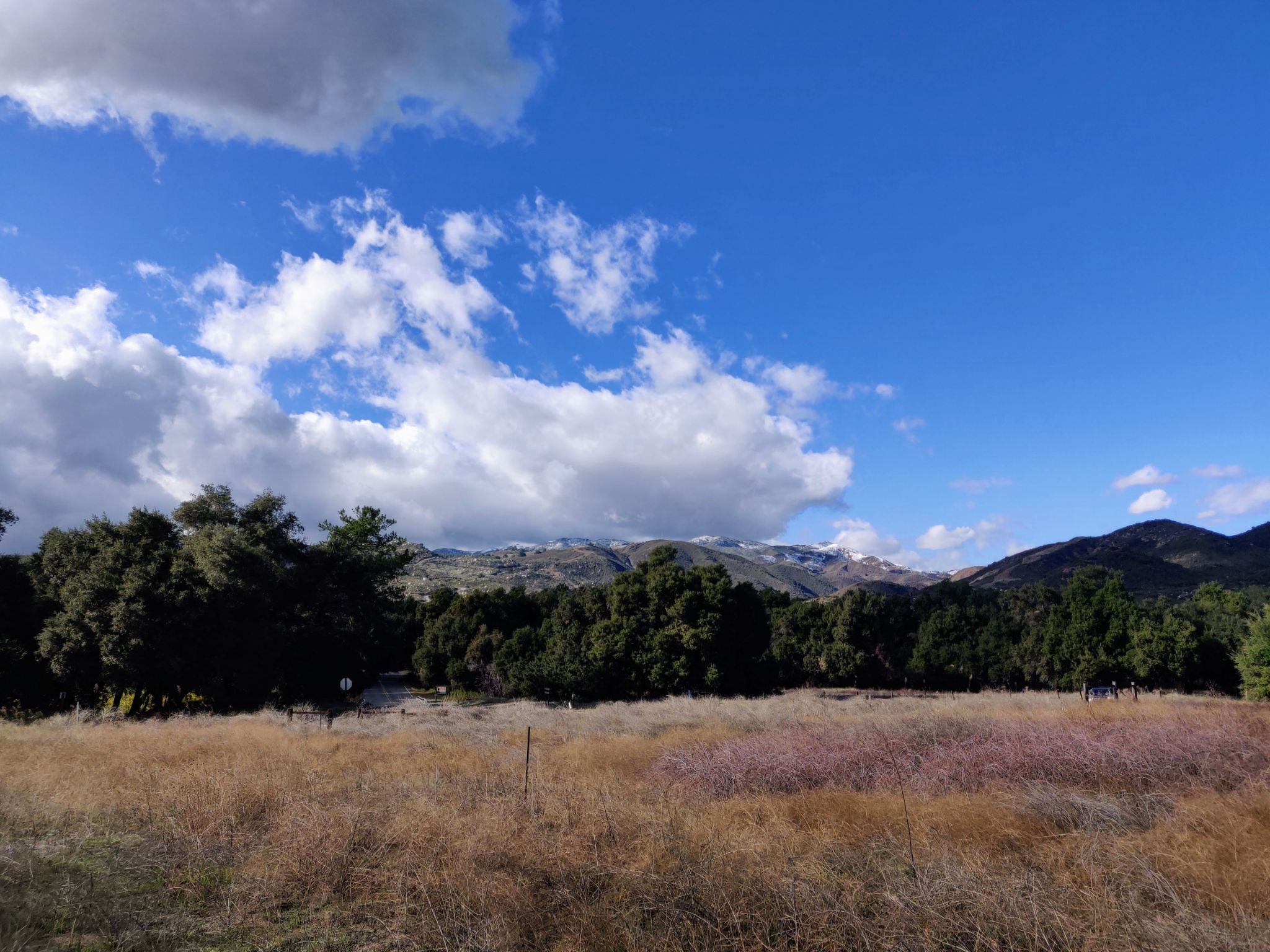
After eating lunch at “las Animas” Lasuén wrote that “around three in the afternoon [we] resumed our journey” in order to, according to Lisalde, “make nightfall at the place of ‘las Lagunitas’ [‘the little lakes’ - possibly Lake Elsinore].” They likely followed the ridge above Decker Canyon near or along today’s Ortega Highway, passing Ortega Falls before reaching Potrero El Cariso. Lasuén wrote that “for a short time we climbed and descended an undulating terrain similar to the one mentioned.” This passage seems to describe the climb up to Potrero El Cariso and then over the terrain above the potrero near the El Cariso fire station before reaching the ridge where the mountains drop precipitously into the Temescal Valley. While Lasuén does not mention the potrero, the party’s route of travel is almost certain given archaeological evidence in the area and its access to a low point in the main divide of the mountains between the ridge leading to Elsinore Peak to the south and the ridge leading to Los Pinos to the north. This is the same low point crossed by the Ortega Highway before descending to the Lake Elsinore area. Of their descent Lasuén wrote that “with much difficulty [we] descended a very long hill, very stony and overgrown, and then, when night had already fallen, we reached an ugly little sandy valley that had scarcely any pasture and only a little puddle of water.” As mentioned earlier, at that time Lake Elsinore was much smaller than it is today. Lasuén made a side note at the end of his entry for this day’s travel that they camped at the “Hormiguero,” meaning an ant-hill or hillock. This may have been today’s Rome Hill near the southern end of Lake Elsinore. The party was exhausted after more than ten hours on the trail covering about 30 miles of riding and 5,000 feet of vertical ascent.
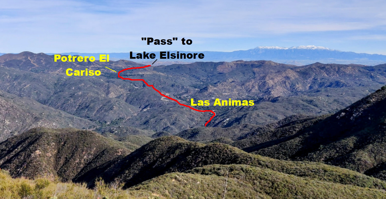
The approximate path followed by the 1797 exploratory party followed an indigenous route that passed through the Potrero El Cariso before dropping into the Lake Elsinore region.
In the following days they proceeded to Temecula, Pala, Pauma, and down the San Luis Rey River Valley to the coast. Lasuén was disappointed with the experience, later writing to another missionary that they went “over roads that are safe to travel only once in a lifetime,” adding “if one does escape with his life he would run too great a risk if he should decide to make the journey a second time.” He concluded that the site most suitable to the establishment of Mission San Luis Rey is the same where the mission is today, which was easily accessible from the Camino Real between San Diego and Mission San Juan Capistrano.
Interestingly, the survey party of 1797 apparently followed a different trail over the mountains than the path beginning at San Juan Hot Springs described by Marcos Forster and Acú and recorded by Harrington. This is somewhat curious since the Spanish colonists at Mission San Juan Capistrano were well aware of the San Juan Hot Springs by the early 1790s. While it’s possible that the trail followed in 1797 was simply the fastest over the mountains to the Lake Elsinore region, it’s also possible that the Acjachemen guides purposely avoided the people living in the Chiquito Basin area of the Potrero Los Pinos. While this is highly speculative, it’s worth considering given the complexities surrounding missionization.
While the survey party of 1797 did not discover anything of immediate importance to the colonists in the Santa Ana Mountains, the information gleaned by the soldiers and Father Santiago was undoubtedly shared with the Mission San Juan Capistrano community. The Potrero El Cariso, and other similar potreros that were visible from the high ridges along the route, were of particular interest because they contained pasture. While pasture abounded along lower San Juan Canyon near the mission, and in various other locations within the mission’s jurisdiction, this mountain pasture would soon become useful.
Potrero Los Pinos - Lost Mission San Juan Capistrano Rancho
The primary economic activities of the missions were stock raising and agriculture. Cattle were raised to supply beef to the mission population. Their hides were used to produce leather products and rawhide and their fat was rendered into tallow for a variety of purposes. Wool from sheep was used to produce textiles and blankets. Missions produced a variety of agricultural products, the primary of which were grain, corn, and beans, but also fruits and vegetables of all kinds from Mexico and Spain. The southern missions in particular produced both white and red wines and liquors. Surplus products were sold to other missions, the pueblos of Los Angeles and San Jose, the four Spanish presidios located in San Diego, Santa Barbara, Monterey, and San Francisco, and foreign and Mexican ships trading along the coast.
All of these economic activities depended on horses. Crops were often located far apart from one another along canyons where there was more dependable water. The several thousand cattle and sheep owned by each mission grazed over hundreds of square miles. As mentioned previously, Mission San Juan Capistrano had livestock and agricultural developments stretching from today's Camp Pendleton to the Santa Ana River. The management of such a vast territory required the mobility of mayordomos (mission foremen), vaqueros (cowboys), ranch hands, and laborers.
The population of horses at the mission generally increased in tandem with harvest yields and the number of mission livestock from the mission’s foundation in 1776 through the late 1790s. The first decline occurred when two hundred horses were given to Mission San Luis Rey for its founding in 1798. The population of horses then quickly rose again, reaching a high of 1408 in 1806, the year the Great Stone Church was completed. Thereafter the population dropped rapidly to 302 by 1811. While this decline likely has multiple causes, it may have been in part due to a toxic plant that killed the stock. This plant may have been toyon, which has berries and leaves that are toxic to horses.
In any case, the plant’s toxicity caused the missionaries to seek pasture in the Santa Ana Mountains. Early Southern California trapper-turned-settler, Juan José Warner (J.J. Warner), remembered that the Potreros Los Pinos, El Cariso, and Ciénaga were used by Mission San Juan Capistrano “since the [my] arrival in this country in 1831 up to about the year 1840 as a place to keep and nourish their gentle horses.” The mission was in decline by 1831, suggesting that the earliest use of the potreros dates back to before that year, possibly as early as about 1810 when horse populations were on the decline. The usage of the potreros required regular travel over the mountains, possibly over the trail from San Juan Hot Springs along or close to today’s San Juan Trail to the Potrero Los Pinos. This may explain why Acú and Marcos Forster later reported this path as being the primary one over the mountains. The mission experienced an increase in the number of horses from 1811 through 1819, reaching 740 in the latter year.
Mission San Juan Capistrano was secularized in 1834 and limped along as a semi-organized free pueblo through the rest of the 1830s. By 1841, however, it was fully converted into private ownership, ending its character as a mission. It was at this time that Warner mentioned that the potreros were no longer being used. In 1845, however, settler John Forster petitioned the government for a rancho in the potreros to pasture his horses because, as was the case with Mission San Juan Capistrano, there was an “herb” that was toxic to horses that he reported as growing between “September and February.” The rancho was granted by governor Pio Pico, Forster’s brother-in-law.
J. J. Warner visited the potreros shortly thereafter, reporting that “I was there in the summer of 1845 and 46, [and] there was there [sic] a small corral which was used for penning the horses when they wished to catch them.” He also reported that there was “a shed made of brush in which his [Forster’s] servants sometimes slept” and that Forster had “from one hundred [to] one hundred fifty gentle horses [at the potreros].” It’s possible that the corral and shed dated to the mission period.
Another laborer working at the rancho, Brigido Morillo, reported that “I am acquainted with the place called Potreros de la Sierra de la Agua Caliente in the jurisdiction of San Juan Capistrano.” He added that “I know the potrero de los Pinos which is on top of the mountain called Sierra de Agua Caliente… and the Potrero Cariso about 1 league more or less from the said Potrero de los Pinos to the eastward and I know the Potrero de la Cienega 3.5 [possibly 3 halves?] leagues a little more or less from the Potrero Cariso in an easterly direction.” He also mentioned a spring at the beginning of the Potrero Los Pinos, likely referring to today’s Chiquito Spring. Interestingly, the mountains were simply named after the San Juan Hot Springs at their base, again suggesting that the primary trail up to the potreros left from just above the hot springs.
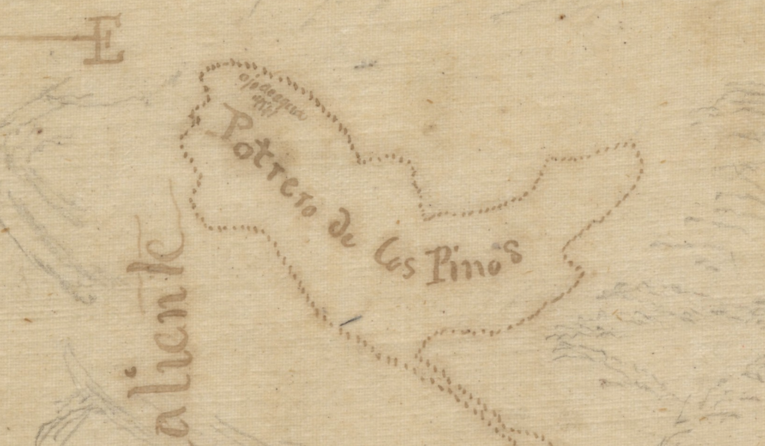
The Potrero de Los Pinos from the diseño of Rancho Potreros de San Juan Capistrano. The “Ojo de Agua” at the top left of the potrero is today’s Chiquito Spring.
The End of an Era
The Santa Ana Mountains came under the control of the United States following the Mexican American War in 1848. Thereafter the mountains continued to be used by indigenous peoples, rancheros, and horse thieves, but also increasingly by settlers from the United States. Much of this history in the early American era has been covered by the likes of historians Terry Stephenson, Jim Sleeper, and Phil Brigandi. The story of horse thieves in the mountains has also been covered on this blog.
While there is certainly much more history that took place in the Santa Ana Mountains during the Spanish and Mexican eras that remains to be investigated, the stories covered in this article demonstrate that the mountains had a continued human presence throughout the Spanish and Mexican eras. Indigenous peoples lived in the Potrero Los Piños prior to colonization and trails crossed both north and south of San Juan Canyon, providing a network of trade from the coast to points inland. The Spanish colonists utilized existing trails and entered the mountains in search of water, to find new locations suitable for missions, and to locate pasture for livestock. When the mission expanded into the potreros to pasture horses, Acjachemen vaqueros continued their presence in mountains, perhaps returning back to the very places that were once a part of their homes before entering into the mission.
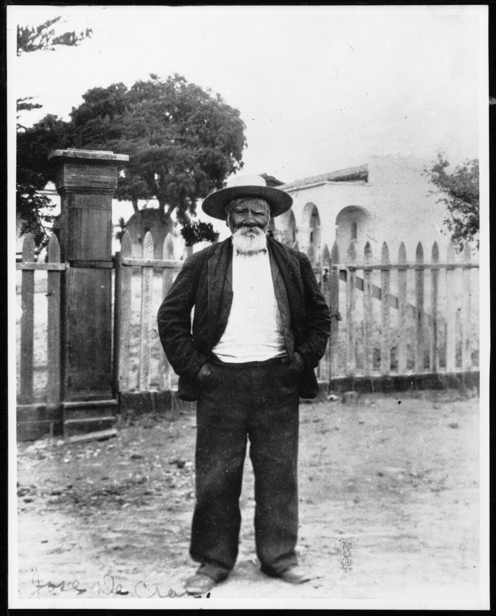
This article is dedicated to the great José Gracia Cruz (Acú)
Part 6: The Great Stone Church (A future post)
Part 10: Richard Henry Dana at Dana Point