Tracing the Trail of the Portolá Expedition in Orange County - San Juan Capistrano Visitor Series Part 3
 The Portolá Expedition passed through this exact spot 250 years ago on July 25th, 1769, about seven years before the Founding Fathers signed the Declaration of Independence. The expedition left from San Diego on July 14th with the goal of establishing settlements on the bay of Monterey. Except for a few relatively minor incursions by outsiders into California's interior before 1769, the Portolá Expedition was the first significant overland expedition through California's interior. Today you can visit the same spot and imagine a very different California, 250 years into the past.
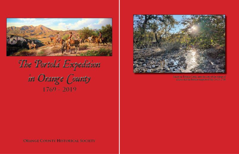
For this post, I will outline our attempt to locate the path of the Portolá expedition through Orange County. The process for determining their route was rigorous. We first made use of the work of previous historians, Terry E. Stephenson, Don Meadows, and Jim Sleeper to get a general idea of where the expedition traveled through the county. We then made careful use of the five surviving journals or accounts from the expedition, those of Fr. Juan Crespí, including both his field journal and first revision, engineer Miguel Costansó (including his Diario Historico, published in 1770 with an English translation available from 1792), Governor Gaspar de Portolá, a fragment of an account written by the primary scout of the expedition, José Francisco Ortega, and an outline of the expedition based largely on the work of Costansó written by the head of the Catalonian volunteers, Pedro Fages. With these sources, we headed out into the field, making numerous trips throughout the county and getting a sense of where the expedition would have likely traveled. A comprehensive Google Earth file was developed to line up the observations of the journalists with the physical features described along the route. Only after we determined our best guess at their route did we learn that the archaeologists generally place the location of Indian village sites in about the same locations we determined that the expedition encountered Indians. Please consult this website, the Early California Cultural Atlas, for further information. In particular, check out the regional profile on the Los Angeles basin, which contains very useful maps and Google Earth files.
That being said, the process of determining historical trails is far from perfect. Disagreement among the expedition's journalists concerning details of the march, including the distance they covered each day, and significant alterations made to the landscape through development make determining the exact route difficult if not at times impossible. Still, there are some locations where we are very confident the expedition marched and/or camped. Some of these locations are covered in development, some of them are still in their natural state.
To further explore the route from northern San Diego County into Los Angeles County, you can download this Google Earth file, "Portolá Expedition in Orange County - 1769," created by Eric Plunkett and Phil Brigandi. To view it, download Google Earth, install and open the program, click on "File" and then "Open." Locate and select the .kmz file "Portolá Expedition in Orange County - 1769". Be sure to check out all of the details preserved in the file's folder system. Please contact me if you have questions or feedback. I would be very interested in anyone who would like to add on to the trail to carry it beyond its current extent, have suggestions for alterations to the route or broader knowledge of the archaeological information related to Indian village sites, etc.
 No artists are known to have made any images of the Portolá Expedition, but a Jesuit Father, Ignacio Tirsch, made a series of watercolors during his tenure as a missionary in Baja California from 1762-1768. His images give us the best idea of the appearance of the members of the expedition. In fact, since the expedition's ranks were mostly filled with Baja Californians, some of the very individuals depicted in Tirsch's images may have later become members of the Portolá Expedition. Today his works are kept in the National Library of the Czech Republic, where they can all be accessed online. The Tirsch image on the left shows a man of some status on horseback, with a typical hat, cape and short pants. For comparison, the cape at the right, which seems to have actually been owned by Portolá, is on display in the California Museum in Sacramento.
Monday, July 23rd, 1769

Monday, July 23rd: From their camp in San Mateo Canyon, the expedition climbed up to a pass on the ridge between San Mateo and Talega canyons. They descended to the bottom of Talega Canyon and then climbed over the low ridge between Talega and Blind Canyons. They proceeded through the tablelands above Blind Canyon, descended down a shallow slope and crossed Gabino Canyon. From here they proceeded one of two ways; northward up a tributary of Gabino Canyon or westward along the north side of Gabino Canyon to its confluence with Cristianitos Canyon. If they proceeded northward up the tributary of Gabino Canyon, they ascended to the tablelands at the head of the tributary, passed between two mounds of red and white clay and entered into the upper reaches of Cristianitos Canyon. If they took the path westward to the confluence of Gabino and Cristianitos Canyons, they proceeded northward through Cristianitos Canyon roughly following Cristianitos Road. Both routes put them along Cristianitos Road in the upper canyon where they continued along its path to the northwest over a small ridge where they descended down Trampas Canyon to San Juan Creek. After crossing the creek, they headed west-northwest to a flat on the north side of the creek just to the southeast of the mouth of Gobernadora Canyon and made camp for the night.
The expedition’s journalists approximated the length of this day’s march to be between 3 and 4 leagues. A line drawn from the San Mateo Canyon camp north-northwest to the next camp on San Juan Creek is in itself about 7.25 miles, or nearly 3 leagues. The relatively small difference between the distance approximated by the journalists and length of the straight line suggests that the expedition must have taken a fairly direct north-northwestern course.
Using this line as a guide, they seem to have climbed to the top of a low point on the ridge between San Mateo and Talega Canyons, which Crespí referred to as “a pass, though not a very steep one.” Continuing north-northwest from the pass, their route proceeded across Talega and Gabino Canyons, corresponding with Crespí’s description of being “through tablelands, knolls, hollows, and dry creeks, going uphill and down…[and] we crossed two hollows with two creeks [Talega and Gabino Canyons], dry ones, but both hollows well lined with sycamore trees and large live oaks.”
Continuing to the northwest from Gabino Canyon, Crespí’s field draft and first revision differ on a key point concerning the location of clay mines along the route. In his field journal, Crespí wrote that they passed “two mines of what seemed good red-earth, ochre, and a very white earth…located at some small knolls, and we passed nearly through their midst.” Crespí used the Spanish phrase “cerca por en medio de ellas,” which can be translated to “nearly in-between them [the mines],” instead of “nearly through their midst.” In the first revision of his journal he wrote that “we went through the midst of two mines situated at ground level with very good red-earth and ochre” which were located at “some knolls upon a tableland about a league before arriving here [to the camp in San Juan Canyon].” In the first revision Crespí used the Spanish phrase “por el enmedio de dos minas” which can be translated to “in-between two mines” instead of “through the midst of two mines.” There are numerous clay deposits which have been worked as mines on the north-south oriented ridge between Cristianitos Canyon to the west and a tributary of Gabino Canyon to the east. If weight is given to the field journal, it seems they traveled northeast to the confluence of Cristianios and Gabino Canyons and then turned northward along Cristianitos Road, where they would pass just below, but near, two large red and white outcrops of clay on the ridge to their right [east]. If weight is given to the first revision, it makes more sense to consider their route being through the tributary of Gabino Canyon, where there are tablelands through which they would have passed between two small knolls containing clay pits of red and white earth. Both routes are “about a league” from the next camp in San Juan Canyon and both end up meeting in upper Cristianitos Canyon, at about where Cristianitos Road splits into western and eastern branches.
Proceeding from the mines, the expedition likely took the more direct western branch of Cristianitos Road, climbed over the ridge above Cristianitos Canyon and descended northward down Trampas Canyon to its confluence with San Juan Canyon. After crossing the wash of San Juan Canyon, they headed west-northwest to a flat on the north side of the canyon, just to the southeast of the mouth of Gobernadora Canyon, a tributary of San Juan Canyon. Crespí described the spot much as it is today, as “a high table-land, at which we camped, and here this same hollow [San Juan Creek] turns north-northwest [down canyon] for about two leagues, with no trees in this direction and without the stream’s running this way.”
A tracing of this route, using either of the two paths containing the clay mines, is about 8.5 miles, which corresponds with the journal estimates of the march being between 3 and 4 leagues.The campsite on this night was the closest the expedition got to the location of today's Mission San Juan Capistrano. The campsite is located about 5 miles up San Juan Canyon (on Ortega Highway) from the mission site today. What should be remembered is that the current mission site dates back to October 4th, 1778, about two years after the mission was founded on November 1st, 1776. The mission was originally founded at the old mission site, about 1.5 miles down stream from the campsite on this night (see the Google Earth file linked at the top of this post). The original El Camino Real was not located along the coast (where it was moved when the mission site was moved to its current location), but instead inland up Gobernadora Canyon when starting from this night's campsite. Much of the land they traveled over in this part of the march ended up being part of Mission San Juan Capistrano's territory when it was founded in 1776. For this reason this post is included as part of the "San Juan Capistrano Visitor Series" on this blog.
 Another watercolor by Father Ignacio Tirsch shows a leather jacket soldier in Baja California. These frontier Spanish soldiers were equipped with a rawhide shield and thick leather jacket to defend themselves against bows and arrows used by the Indians. Their offensive armament included a carbine, sword, typically a lance (not shown here) and also a short firearm such as a blunderbuss (also not shown here). This is what the soldiers who came with the Portolá Expedition would have looked like while traveling though what is today Orange County.
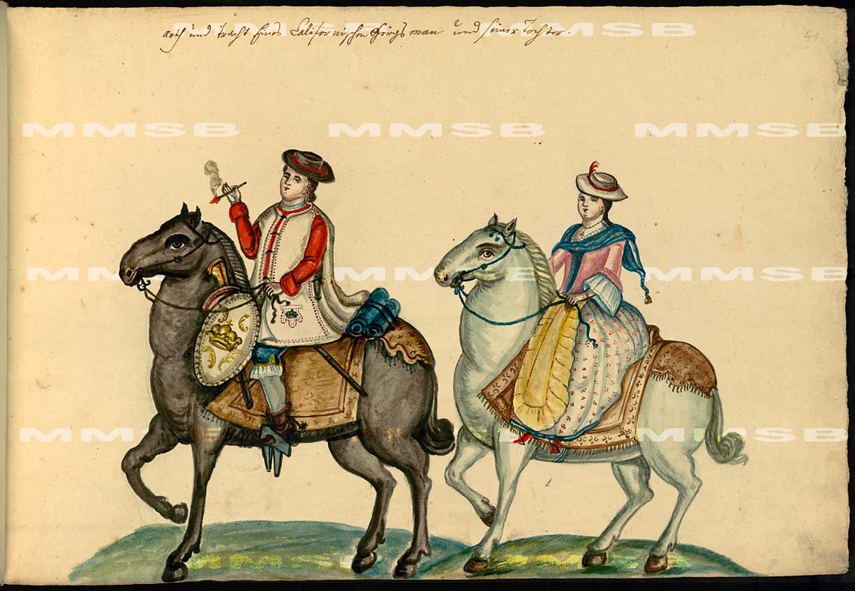
Tuesday, July 24th to Wednesday, July 25th, 1769

Tuesday, July 24th: From the camp on the flat above the confluence of San Juan and Gobernadora Canyons, the expedition descended into Gobernadora Canyon and headed due north up its course. They veered slightly west into Wagon Wheel Canyon, a tributary that runs parallel to Gobernadora, where they roughly followed today’s Oso Parkway. They continued until they reached the end of Wagon Wheel Canyon and then veered westward along or near Oso Parkway’s bend to the west over a pass into the upper reaches of Chiquita Canyon. This pass is either the same crossed by Oso Parkway or one of the small passes in its vicinity. From the pass, they gently descended into the tablelands at the head of Chiquita Canyon, likely trending northward along or just east of the 241 toll road. At a low point on the ridge between Chiquita and Tijeras Canyons, they descended westward through or close to today’s Canada Vista Park and crossed the Tijeras Creek Golf Club just north of the Trabuco Adobe site. Taking a northward course on the table lands just above the east side of Trabuco Creek, they set up camp on a flat above the creek, just west-southwest of Lone Hill.
Night of Tuesday, July 24th – Camp in Trabuco Canyon – San Francisco Solano
Night of Tuesday, July 24th – Camp in Trabuco Canyon – San Francisco Solano
Day of Wednesday, July 25th: A day of rest. The scouts continued northwest all the way to Santiago Creek, probably taking a very similar route that the entire expedition took over the following two days.
Night of Tuesday, July 25th – Camp in Trabuco Canyon – San Francisco Solano
Night of Tuesday, July 25th – Camp in Trabuco Canyon – San Francisco Solano
Crespí wrote that they started this day’s march by first coming “down off a high tableland where our camp had been made” and entered into a dry canyon on a “north-northwesterward course” with “not a tree toward this quarter, nothing but ground and grass.” While Crespí indicated that their path continued up San Juan Canyon, Costansó and Fages more accurately described it as a tributary that “opens into that of Santa Maria Magdalena [San Juan Canyon].” The proximity of their camp on the tableland north of San Juan Creek at its confluence with Trampas Canyon suggests that the dry and treeless north-south trending canyon they descended into was Gobernadora Canyon.
Crespí recorded that they marched for “two leagues” and then “changed course to northwest veering a good deal to westward, in order to go up a high pass through grassy rolling hills.” Costansó and Fages indicated that this turn to the west was necessary because they reached the end of the canyon. Since Gobernadora Canyon is about 3 leagues in length, they must have taken course up the shorter Wagon Wheel Canyon, a tributary running northwest from Gobernadora Canyon. Unlike Gobernadora Canyon, Wagon Wheel Canyon terminates after about a 4.5 mile walk, or a little less than two leagues, from the previous night’s camp in San Juan Canyon. No other canyon running northward from San Juan Canyon contains topography conforming to the journal descriptions.
After crossing the “pass” between Chiquita and Wagon Wheel Canyons somewhere in the vicinity of Oso Parkway, the expedition descended a short distance into the flats in upper Chiquita Canyon. From here they must have turned again to the north-northwest, paralleling just east of today’s 241 Toll Road. Though Crespí does not mention a change in direction, Fages implied that the whole day’s journey was to the northwest “without change of direction” except for the relatively short turn to the west to get over the pass.


Crespí estimated this day’s march to be 2.5 leagues while Costansó estimated it to be about 3 leagues. Portolá recorded that they marched for 3 hours.


Crespí, Costansó and Fages all agreed that this day’s march was two leagues while Portolá recorded that they marched for 3 hours.
As they proceeded up Chiquita Canyon, Crespí wrote that they traveled “over good-sized tablelands” while Costansó and Fages described “a wide stretch of level country,” much as it appears today. At some point they must have descended into the Trabuco Mesa country containing the Tijeras and Trabuco Canyon watersheds. Instead of climbing over one of the higher points on the ridge between Trabuco/Tijeras Canyons and Chiquita Canyon, they probably headed to the northwest, continuing to parallel just east of the 241 Toll Road, before crossing the ridge, and the toll road, at a low point in the vicinity of today’s Canada Vista Park in order to descend down to Trabuco Mesa.
Continuing northwest across the tableland between Tijeras and Trabuco Creeks, the expedition probably passed just south of the rise that leads up to Lone Hill and reached Trabuco Creek near the intersection of Arroyo Vista and Paraiso streets. Crespí described the spot much as it appears today, “a pleasant stream and cañada [canyon] all lined with a great many large alders and large live oaks, so that the entire bed of this hollow looking so handsome makes a very agreeable effect, seeming like a fig orchard.”
From this spot, they likely continued northward for a short distance along the flats east of the creek in order to reach a more suitable campsite on the large flat just west-southwest of Lone Hill. This location agrees with the descriptions of the campsite in the journals for several reasons. First, Crespí described climbing “a high knoll belonging to the spot [the camp]” from which they were able to see San Clemente and Santa Catalina Islands. This hill was almost certainly Lone Hill, which is both accessible by foot or horseback, high enough to view San Clemente and Santa Catalina Islands from its crest, and the only obvious high point adjacent to the flats east of Trabuco Creek. Crespí even wrote that the scouting soldiers “found this place [the hill]” and climbed it the day before, which was probably why the camp was set up adjacent to it. Second, Crespí wrote that he could see where the canyon originated, “perhaps a league farther up, at the foot of the mountains not far off” and Costansó and Fages both described the creek running at the “foot of a mountain range.” If they were able to see the path of Trabuco Creek as it ran at the foot of the mountains below Old Saddleback, they must have been in the flats west-southwest of Lone Hill, not further down canyon because Lone Hill blocks the view. Third, Crespí described the canyon as “seemingly broader down toward the southward.” This description makes more sense if it was written further up canyon because it becomes quite obvious from even a short distance down canyon that it broadens in that direction. Fourth, when the expedition continues on its way a couple days later, they exited Trabuco Canyon through a small tributary to the northwest, which is likely the same through which Santa Margarita Parkway runs northwest out of Trabuco Canyon today. On the day the expedition moved on, Crespí indicated that they immediately left Trabuco Canyon through this small tributary, writing that “On setting out we took up our course northwestward, leaving San Francisco Solano [Trabuco Canyon] through a small canyon that led us in that direction.” His use of the word “immediately” suggests that the camp was located near today’s Santa Margarita Parkway.
A tracing of the route on this day’s march is about 8.4 miles, corresponding with the journal estimates of 3 leagues.
A general view of the flat where the expedition camped in Trabuco Canyon, with Old Saddleback on the horizon. Imagine this scene as it was in 1769, with the expedition's animals grazing throughout the flat, the leather jacket soldiers, mule drivers, local Indians and the Indians traveling with the expedition from Baja California, spread out in groups around the fires burning from oak gathered near the creek. Crespí recorded that the tents of the expedition were set up near a lone tree which once stood in the middle of the flat. It was in this area that some member of the expedition lost his blunderbuss, or "trabuco" in Spanish, giving the canyon its name. It was here, too, that the Indians from the nearby village of "Alauna" came and gave gifts of sage (like chia) and grass seeds to the expedition members, much to their appreciation. To the right of this photo is "Lone Hill," which was climbed by the scouts who located the campsite and by Fr. Crespí, Lt. Fages and a couple soldiers to get a view of the ocean to get their bearings. Since this was the first overland expedition through California, they had to rely on the information preserved in the previous sea expeditions and explorations along the coast.
In 1787, a painting was commissioned in Mexico City to portray Father Junípero Serra receiving the sacrament in Final Communion. Serra died in 1784 at Mission San Carlos Borromeo near Monterey during the governorship of Pedro Fages, head of the Catalonian volunteers during the Portolá Expedition. A distinctive face appears in the background of the painting (shown above left), which is speculated to be an image of Fages. In 1786 a French scientific expedition under Jean-François de Galaup, comte de Lapérouse, stopped in Monterey and a sketch was made at Mission San Carlos Borromeo of his reception by someone of some importance in California (shown above in the middle). Comparing the image in the middle with the official portrait of the French captain at right, it's clear that the artist at Mission San Carlos Borromeo attempted to accurately portray some facial features and hair styles. Interestingly, the man on the left looks very similar to the man in the background of the painting made in Mexico City. Could it be Fages? It seems quite possible given that he was governor of California at the time the French expedition visited the Monterey area. These may be the only accurate images of a member of the Portolá Expedition - a member we know stood on Lone Hill in O'Neil Park and gazed out to sea, just as you can today.
Looking towards the sea from the top of Lone Hill in O'Neil Park. On a clear day both Santa Catalina and San Clemente Islands are visible. The expedition was mostly reliant upon a sailing guide for the Manila Galleons written in 1734 by a ship pilot, Cabrera Bueno, to identify landmarks along the coast. While atop Lone Hill, the expedition's members would have been reading pg. 304-305 for references about the islands along the coast here. A translation of Costansó's 1770 publication celebrating the achievements of the Portolá Expedition into English was made in London in 1790, and contains a translation of Cabrera Bueno's sailing directions (see pg. 52 for a general translation of the above referenced pages from Cabrera Bueno's sailing guide). As previously mentioned, much of the story of these early sailing expeditions and explorations is covered in my article on Manila Galleons and the Vizcaino Expedition.
This image of a leather jacket soldier comes from Mexico, but shows that the typical sidearm (labeled number 6) may have been somewhat loosely secured. On his day off in the country in and around Trabuco Canyon, which is filled with brush and steep hillsides, perhaps a soldier's blunderbuss (trabuco) loosened from its mount while on the move, becoming lost but immortalized in the name "Trabuco" Canyon. We'll likely never know for sure, but the very blunderbuss which gave Trabuco Canyon its name could still be out there, somewhere within or near O'Neil Park. Phil Brigandi points out that the soldier probably had a very bad time explaining the loss of such an important piece of equipment to his superiors, especially being on the very fringes of the Spanish frontier. It seems possible that if his superior made enough of an example of him, that the other soldiers could have affectionately reminded the poor soldier of his error by naming the canyon after the event.
Thursday, July 26th, 1769
Day of Thursday, July 26th: Heading northward up Trabuco Canyon just before it turns to the northeast, the expedition continued northwest up the tributary probably followed by Santa Margarita Parkway today. They left the path of Santa Margarita Parkway at about its intersection with El Toro Road, heading west-northwest along but south of the 241 Tollroad. They continued across Bake Parkway, just southwest of its intersection with Rancho Parkway, and continued through or near Promenade Park at Baker Ranch and across Alton Parkway. They proceeded over a low pass, possibly down the wash of the lowest reaches of Round Canyon, and reached the flats. They proceeded around a small hill south of Portolá Springs Elementary School, and set up camp in the vicinity of the school itself and Portolá Springs Parkway. From near the camp, they spotted Tomato Springs on the hillside just above the eastern terminus of Desert Bloom Road, where they were able to obtain water for the men, but not the animals.
From the Trabuco Canyon camp, Crespí recorded that the expedition took up a route through a tributary near their camp, writing that “on setting out” they headed “northwestward, leaving San Francisco Solano [Trabuco Canyon] through a little canyon that led us in that direction.” This little canyon was very likely the same traversed by today’s Santa Margarita Parkway as it heads west out of Trabuco Canyon because the tributaries further up canyon from Santa Margarita Parkway would have pushed the expedition along Trabuco Canyon’s bend to the northeast, away from their intended course to the northwest while any tributaries down canyon are much shorter and steeper.
After leaving Trabuco Canyon, Crespí described traveling “over very open country of very low rolling knolls and tablelands, all very grass-grown, up hill and down through three or four canyons with very good soil and a great deal of sycamore trees in the canyons.” These “three or four canyons” along their path from east to west were Oso Creek, Aliso Canyon and Serrano Creek, while the “or four[th]” canyon was either Borrego Canyon or Agua Chinon. Their route must have taken them north of English Canyon, otherwise Crespí would have had to count four or five canyons instead of three or four. Given Crespí’s description of “low rolling knolls and tablelands,” it’s not surprising that this region was only more recently developed into housing tracts and shopping centers as they continue their own march further and further into the hills.
The expedition was on its way towards Santiago Creek, which was reached by the scouts the day before but too far to reach on this day’s march. Without a natural water source to guide them to a campsite, they seem to have settled on making camp upon reaching the flats of the Irvine Ranch, northeast of the former El Toro Marine Base. After a day of traveling through the hills, perhaps they considered their arrival at the flats as a good “hiker’s halfway point” to Santiago Creek. Given the topography and the expedition’s regular route of travel to the northwest, they may very well have entered these flats at the bottom of Round Canyon. A route in this vicinity can also be inferred by its proximity to Tomato Springs, which were discovered and used by the expedition after they stopped for the day. Costansó recorded that Friar Gomez discovered Tomato Springs, not the scouts the day before. It would have been easy to miss the small green patches of vegetation marking these springs on the hill to the north, especially since they would have likely only been visible when the scouts were returning from Santiago Creek back to their camp in Trabuco Canyon. After the whole expedition arrived at the flats near Tomato Springs, perhaps Friars Gomez and Crespí had a look around, as they did after the next day’s march to Santiago Creek, and discovered the springs.
Crespí wrote that they “made camp across from a dry lake on the opposite side of the two small springs.” Given the topography, this “dry lake” was very likely the former site of Lambert Reservoir, now occupied by the appropriately named Portolá Springs Elementary School. Crespí’s remark that they were on the “opposite side of the two small springs” suggests that they camped in the vicinity of Portolá Springs Road, west southwest from the school but northwest of its intersection with Modjeska Road.
A tracing of this route is just about 7.3 miles, corresponding with this day’s march being 2.5-3 leagues in length.
 Tomato Springs, located in the trees at the center right of the photo, were a source of water for the expeditions' members, though there was not enough for the pack animals. The scouts had planned on not having water for this night's camp, prompting Portolá to order that they fill two barrels with water prior to leaving Trabuco Canyon. Fortunately for the expedition camped on the flats, one of the two padres, Father Gomez, explored a patch of greenery on the hillside and discovered the spring, possibly while taking a walk when doing his evening prayers.
 The expedition camped on or near the site of Portolá Springs Elementary School (left center of the photograph), which is the site of a dry lake hundreds of years ago which later became the Lambert Reservoir before the school was built on top of it. Crespí simply described it as a dry lake in 1769. On the expedition's second journey up to Monterey in April of 1770, Crespí mentioned that Catalina Island was visible from these springs and it can just be made out below the clouds in the above photograph.
Tomato Springs, located in the trees at the center right of the photo, were a source of water for the expeditions' members, though there was not enough for the pack animals. The scouts had planned on not having water for this night's camp, prompting Portolá to order that they fill two barrels with water prior to leaving Trabuco Canyon. Fortunately for the expedition camped on the flats, one of the two padres, Father Gomez, explored a patch of greenery on the hillside and discovered the spring, possibly while taking a walk when doing his evening prayers.The expedition camped on or near the site of Portolá Springs Elementary School (left center of the photograph), which is the site of a dry lake hundreds of years ago which later became the Lambert Reservoir before the school was built on top of it. Crespí simply described it as a dry lake in 1769. On the expedition's second journey up to Monterey in April of 1770, Crespí mentioned that Catalina Island was visible from these springs and it can just be made out below the clouds in the above photograph.Friday, July 27th, 1769
Day of Friday, July 27th: The expedition headed northwest, paralleling just south of Portolá Parkway. They passed between Red Hill and Lemon Heights and continued just south and west of Red Hill School. Their path took them through Newport Boulevard between East 17th Street and La Loma Drive, and just southwest of Foothill High School. They continued northwest, crossing Chapman Avenue near Prospect Street, through or just west of El Modena High School. They probably set up camp on the south side of the creek, just west of Grijalva Community Park.
Crespí, Costansó and Fages all agree that this day’s march was 3 leagues and Portolá recorded that they traveled for 3 hours. After many days of contending with hilly country, this day’s march was entirely along the flats between Tomato Springs and their destination, Santiago Creek. The hills in this region originate from the flats along a roughly northwestward line, shaping the expedition’s course to the northwest along the flats from their camp near Tomato Springs. Crespí referred to these hills as the “bare mountain range that we are keeping upon our right to northward” and that it “seems very grass grown.” He was also prescient in his prediction that the flat, which he described as “vastly great in leagues,” could potentially one day “support a city.” Two and a half centuries later, this flat contains the cities of El Toro, Irvine and Tustin.
The scouts may have directed the expedition’s course towards Red Hill, which is an obvious landmark to the northwest from the Tomato Springs area. On setting out, Crespí wrote that “in the distance we saw a great deal of trees,” which probably referred to those that once stood in the swamp lands at the southern base of Red Hill. Writing in 1930, the Orange County historian, Terry Stephenson, determined that this swamp would have forced the expedition to pass north of Red Hill, between it and the hills of Lemon Heights, especially on a wet year such as 1769. A path through this “pass” also makes sense for another reason; it was the most direct route to Santiago Creek. After passing Red Hill, there were no hills to prevent them from turning slightly more northward along the straightest and shortest route to Santiago Creek.
Crespí may have subtly suggested that the expedition set up camp on the southeast side of the stream, writing “[w]here we set up camp, Father Gomez and I saw quite a large stream in among dense willow, sycamore, and live-oak, which seem[s] to run along to northeastward from this spot.” If they had crossed Santiago Creek before setting up camp, it seems he would have mentioned the creek before seeing it from camp. Then again, none of the journalists record crossing the creek the next day on their way to the Santa Ana River, opening up the possibility that they camped on the north side of its banks as well (though this stretches the length of the march well beyond 3 leagues). One point seems certain, they were positioned on the portion of Santiago Creek that runs from the northeast to the southwest, not further up or down stream where it generally runs more closely along an east-to-westward course.
Interestingly, a tracing of the route from Tomato Springs to a camp near Grijalva Community Park is about 9.3 miles, a distance of about 3.5 leagues and half a league longer than the journalists’ consensus that this day’s march was about 3 leagues (decreasing the possibility that the camp was located north of the creek). Perhaps the expedition was able to cover more ground traveling on the flats compared to the hills within the same amount of time, leading to their underestimate of the true distance they traveled this day. Since their camp must have been at Tomato Springs (there are no other springs along the base of the hills) and their destination must have been Santiago Creek (there is no other water course which could have been their destination), it is probable that the journalists’ truly underestimated the length of this day’s march.


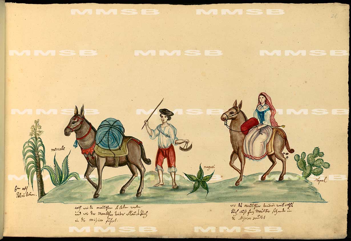
Seven "arrieros," or mule drivers went along with the expedition to Monterey in 1769. Costansó reported that there were four divisions of animals driven by these mule drivers, carrying the expedition's supplies. Their job was incredibly difficult. Not only did they have to contend with the clouds of dust kicked up by the animals each day, taking great effort to get the animals over difficult ground, but they also had to keep watch over the animals at night to make sure they didn't stampede when startled by coyotes, wolves or bears. It's not hard to imagine very difficult nights, far out on the frontier, needing to keep a keen eye on the animals in the pale moonlight. On the night of April 23rd, 1770 while camped on the south side of the Santa Ana River near Olive during the expedition's second trip up to Monterey, Crespí recorded that the "mounts were stampeded, running over two leagues [about five miles] away; whether they smelled wolves, of which, so they say, a great many large ones have been seen, or perhaps bears, whose traces are now visible, we cannot tell." The animals probably ran southward down the river, onto the plain where the city of Orange is today. Such events remind us that the path of the expedition was anything but linear. The image above is another made by Tirsch in Baja California.
Saturday, July 28th, 1769
Day of Saturday, July 28th: The expedition continued to the northwest, crossing the 55 Freeway between Katella and Collins Avenues. They proceeded across Katella Avenue near its intersection with Tustin Street. Keeping a direct course to the northwest, they passed near the intersection of Lincoln Avenue and Glassell Street and set up camp on the south side of the Santa Ana River along its bend between Lincoln Avenue and Glassel Street.
Crespí wrote that this march was a “scant league and a half,” while Costansó described it taking an hour and Fages described it as just one league. Portolá, interestingly, recorded that they traveled for 2 hours. Crespí also recorded the distance based on the scouts reconnaissance the day before, writing that the “scouts arrived back last night [to the Santiago Creek camp] and said they came across a full-flowing river a league and a half away.”
Crespí wrote that the expedition followed the “same northwestward course of these last days’ marches, keeping on over this same plain along the skirts of the range we have been keeping to our right (to the north).” This “range” generally refers to the hills above Santiago Creek, but the hills “to the north” from where they were are today’s Peralta Hills. The expedition aimed their course to the northwest, just to the west of where the Peralta Hills descend into Olive and the Santa Ana River. By doing so, they intended to reach the Santa Ana River at its bend near Olive, which would allow them to ford the river along their northwestward course. Given Crespí’s description of their crossing the Santa Ana River the next day, they must have made camp south of the river, somewhere along the river between Lincoln Avenue and Glassell Street.
A tracing of this route from a camp located south of Santiago Creek to the approximate location of their camp near the Santa Ana River is about 3.8 miles, conforming rather convincingly to the varied estimates of the length of this day’s march recorded by the journalists.

Artist Joanne Haskell Crosby, whose husband, Harry W. Crosby, is one of the great California historians of the Spanish colonial era, created modern renderings of Tirsch's watercolors in the 1990s. Pictured here is one of the leather jacket soldiers, giving us the best possible impression of what these frontier Spanish soldiers looked like while traveling through Orange County in 1769.
Sunday, July 29th, 1769
Day of Sunday, July 29th: After crossing the river, the expedition traveled north-northwest between Kraemer Blvd and the 57 Freeway. They passed just east Cal State University Fullerton, crossing the 57 Freeway in the vicinity of its intersection with Yorba Linda Boulevard. They then turned to the northwest to cross the East Coyote Hills, probably somewhere above Fullerton Dam. They then crossed Brea Boulevard between Rolling Hills Drive and Elm Street and descended into Brea Canyon. Their camp may have been made on or near the hill where Arovista Elementary School sits today, or to the west above the canyon as far south as the bend near Loma Vista Memorial Park.
From the camp on the Santa Ana River near Olive, the expedition crossed the Santa Ana River heading northwest. Crespí wrote that “[on] setting out we pursued a northwestward course keeping on across this long, large plain,” which is today occupied by Anaheim, Fullerton, and Placentia. He continued, writing “alongside us upon the right, to the north, run two chains of mountains, one of them very high and dark and about four leagues off, and the nearer one middling high, about a league and a half away.” The “chain” which was “four leagues off” is the Chino Hills while the other, at “about a league and a half away,” is the East Coyote Hills, which run from the northeast near Craig Park and the Fullerton Dam to the southwest where they descend into the flats just above Fullerton College.
Crespí then wrote that on “going a short way we changed course to the north-northwestward.” This turn was probably made in order to cross the East Coyote Hills at their northeastern end, where they descend into La Habra Valley beyond the Fullerton Dam. If they had simply continued their course to the northwest, they would have had to contend with the hilly country above Fullerton College in the Hill Crest Park and Brea Dam areas. Their only other option was to head westward to find a way around the West Coyote Hills, which did not look promising from what they could observe from the Santa Ana River camp. Had they known there was an easy route around the West Coyote Hills, they would have taken it, as they did on their return trip along what became the El Camino Real.
Crespí wrote that after “a league and a half [from camp]” they “turned back again to the northwest, so as to get to go up the first, closest range [East Coyote Hills], which had become very low and to west-northwestward shortly came to an end.” Following a north-northwestward route for a league and a half from the Santa Ana River camp places their turn back to the northwest somewhere in the northeastern portion of Cal State Fullerton, from which, as Crespí described, to the “west-northwestward [the hills] shortly [come] to an end.” They must have been aiming to cross the East Coyote Hills north-northwest of Cal State Fullerton where they are relatively lower and “shortly [come] to an end” in the La Habra Valley.
Taking this northwestern route, Crespí described ascending a “low rolling very grass-grown little knoll” somewhere in the vicinity of Fullerton Dam, where the hills do not rise more than 200 feet above the flats. Though a somewhat puzzling choice considering they could have proceeded into La Habra Valley through today’s Craig Park, Costansó explained that they left the “level country and the coast to enter the mountains, as we feared a lack of water in the plain.” Given their northwestward course, it seems that they crossed Brea Boulevard in the vicinity of Rolling Hills Drive and Elm Street.
Crespí then wrote that they “soon came down to a small, very green hollow with a small pool of water and a large village of very fine friendly gentiles.” Costansó described the same spot as containing “some little springs or small pools in a narrow canyon.” The canyon can be no other than Brea Creek. Given the expedition’s sudden turn to the northwest over the hill to reach it, the scouts must have discovered it the day before. This suggests that the “pool of water” must have been located near La Habra Valley, where the scouts could have more easily discovered it the day before on their way to or from the San Gabriel River, which they reached by climbing over the Puente Hills.
Given the expedition’s course and Costansó’s description of the “little springs or small pools” being in a “narrow canyon,” they must have been on Brea Creek towards La Habra Valley, not down at the relatively wider section near Brea Dam. The pool of water or little springs was/were probably located along the portion of Brea Creek that runs northeast to southwest near the entrance to the Brea Creek Golf Course, or down canyon towards its turn near the Loma Vista Memorial Park.
Crespí reported that they “made camp at a very grass-grown knoll next to here [the pool of water]” which was “about a musket shot away.” A “musket shot away” in 1769 indicated an approximate distance of up to 300 yards, placing their camp relatively close to the canyon bottom. Crespí also wrote that “[i]mmediately upon coming down from the knoll here [their camp] there is a large valley of some leagues of very good grass-grown soil, but with no more water than in the aforesaid little pool.” He also seemed to indicate that, from the pool of water, this large valley was “[b]eyond this knoll [the camp].” The large valley is today’s La Habra Valley, which suggests that their camp was on the north or western side of Brea Creek, from which they could “immediately” descend into La Habra Valley. As they reached Brea Creek near the Brea Canyon Golf Course, they may have set up camp on or near the site of Arovista Elementary School, which is on a conspicuous knoll above the creek and from which there is an easy descent into La Habra Valley. They could have also been on the relatively flat hills above Briarwood Drive or Arbolado Drive.
 One of Tirsch's sketches during his time in Baja Califiornia in the 1760s was of the governor, Fernando Rivera y Moncada, who generallly traveled in the rear of the expedition. On the left is the original sketch and on the right is the redrawn sketch by Joanne Crosby. It is hard to say to what degree Tirsch included accurate facial features, especially considering the similarity between Rivera's face and the other characters in his drawings. Rivera's clothing is not typical of what he would have worn during the expedition, but still gives us an impression of the style of clothing used in the Spanish colonies at the time.

The expedition’s journalists estimated this day’s march to be 4 leagues while Portolá recorded that they traveled for 4 hours.


A tracing of this route is about 6.1 miles, agreeing with the journalists’ estimates that this day’s march was 2 leagues (Crespí says a little more than 2 leagues) in length and 3 hours of travel time.

Looking south-southeast from the Panorama Nature Preserve above Cal State Fullerton. The general line between the hills and the flats produced by centuries of sediment deposited by the Santa Ana River largely determined the route taken by the expedition. Where the red line begins on the right side is about where the expedition passed by Red Hill above Tustin. The camps at both Santiago Creek and the Santa Ana River are also visible. The expedition's path through Placentia and Fullerton was determined by going around the east side of the East Coyote Hills, the highest ridge of which is within the Panorama Nature Preserve.
One of Tirsch's sketches during his time in Baja Califiornia in the 1760s was of the governor, Fernando Rivera y Moncada, who generallly traveled in the rear of the expedition. On the left is the original sketch and on the right is the redrawn sketch by Joanne Crosby. It is hard to say to what degree Tirsch included accurate facial features, especially considering the similarity between Rivera's face and the other characters in his drawings. Rivera's clothing is not typical of what he would have worn during the expedition, but still gives us an impression of the style of clothing used in the Spanish colonies at the time.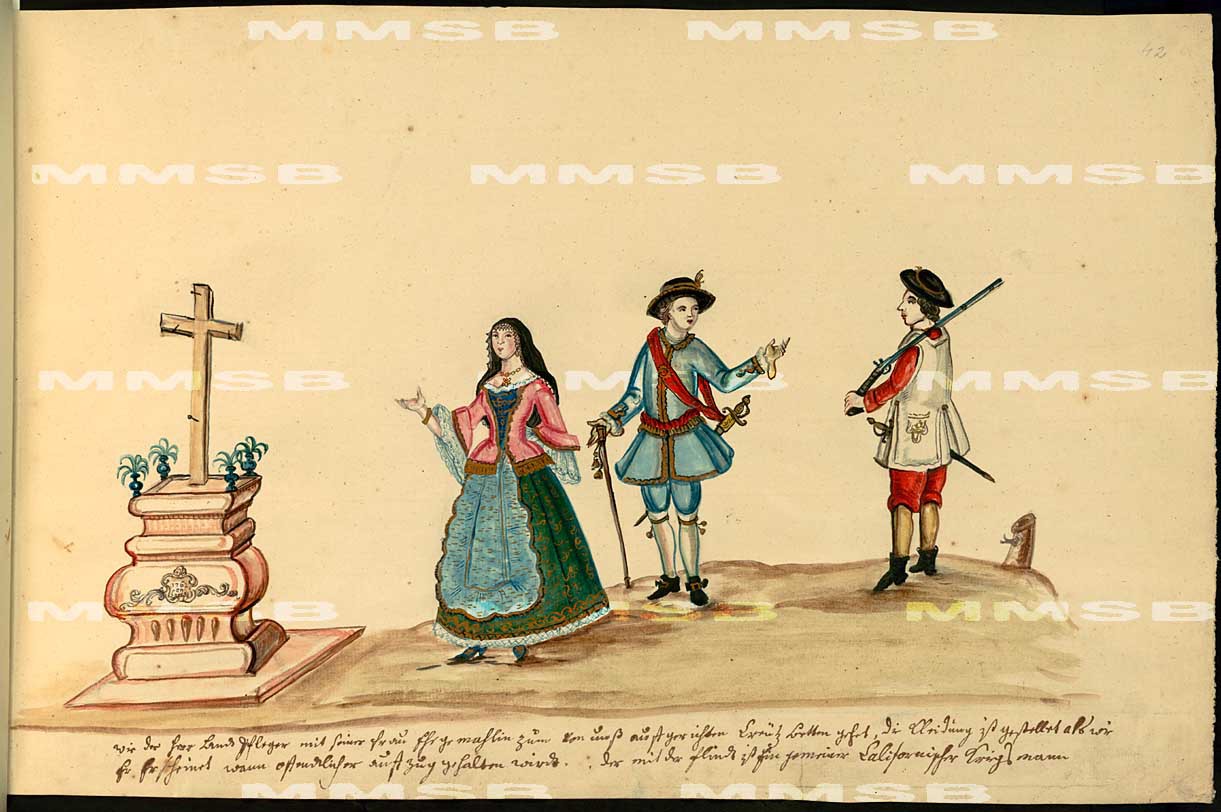
Monday, July 30th, 1769
Day of Monday, July 30th:
The expedition’s journalists estimated this day’s march to be 4 leagues while Portolá recorded that they traveled for 4 hours.
From their camp above Brea Creek, Crespí wrote that “[we] went down the knoll and crossed the large valley I spoke of [La Habra Valley].” When scanning the horizon line of the Puente Hills today from near their camp on Brea Creek, an obvious “pass” can be seen to the north-northwest at about where Fullerton Road passes over the hills today. For this reason, Crespí described “taking a course due north-northwestward” across La Habra Valley while Costansó wrote that they started in “a northerly direction, steadily approaching the mountains [Puente Hills].”
Taking this route, they probably reached the base of the Puente Hills somewhere north-northeast of the intersection of Harbor and Whittier Boulevards. Continuing up the hills, Crespí wrote that they “went up a pass, and came into hollows [small canyons] with very large live oaks and sycamores.” The “pass” is likely near the intersection of Fullerton and Kanola Roads. The country in this area is rather flat, though at the top of the hills, laying in-between no less than three ridges. At this point in the march, Costansó recorded that they “topped some fairly high, broken hills,” conforming to the topography as it exists today.
After going up the pass, Crespí implied that they took a course through more than one canyon, writing that they “came into hollows [plural] with very large live oaks and sycamores.” The area in the vicinity of the pass roughly divides two water courses; La Mirada Creek to the west and Powder Canyon to the east. To maintain their north-northwestward course, the expedition likely dropped into the upper reaches of Powder Canyon before climbing north-northwest over the ridge where the canyon begins. At this point they descended into a separate canyon which drains to the north, through which today runs the confusingly named “Powder Canyon Motorway,” though not in Powder Canyon, and terminates to the north at the Peter F. Schabarum Regional Park.
At this point, Crespí wrote that they had “traveled three hours and must have made three leagues as well, at which we came down to a very wide-reaching, spacious valley of very level dark friable soil, all burnt off by the heathens.” They seem to have entered the valley, which can be none other than that which San Jose Creek flows today, between Hacienda Heights to the west and Rowland Heights to the east. Of note is that a tracing of this route today shows that the total distance that they would have traveled from their camp on Brea Creek through their exit from the Puente Hills is only a little over six miles, short of Crespí’s estimate. Since this is the longest possible route over the Puente Hills along a north-northwestern course, as the extent of the hills to the west and east do not cover as much distance along a north-northwestern course, perhaps Crespí over-estimated the distance they had traveled because of the extra exertion necessary to traverse the hills.
After leaving the hills, Crespí implied a turn to the northwest, writing that they traveled “about a good league through this valley,” which he described as trending “east to west” with a “width” of “three leagues between hills from north to south.” Since the expedition intended to work their way west-northwestward the next day, they likely took the longer and less direct northwest route to San Jose Creek, rather than the shorter and more direct route due north. By doing so, they would have reached San Jose Creek at about the confluence of San Jose and Puente Creeks, just north-northeast of Hillgrove, where they made camp.
The confluence of water courses can often be accompanied by marshes, which may explain why Crespí described the spot as “a swamp in this large level” which was “very green with tall grass clumps, wild grapevines looking as though planted, countless rose of Castile bushes; so much cumin that double-hundredweights’ worth could have been gathered, a great deal of it being in seed and a great deal in flower; and all kinds of very lush plants that we could not recognize” through which flowed “quite a large stream” containing “a buey’s worth of very good, fresh pure water.” For comparison, Crespí described Santiago Creek as containing “over a buey of water,” implying that it was larger than the water course crossed on San Jose Creek. Describing San Jose Creek, Costansó remarked that there was an “abundance of water, part of it running in deep ditches, part of it standing so as to form marshes.” His use of the plural “ditches” also may imply the confluence of two water courses.
The expedition made their camp on the furthest west, and apparently deepest, ditch of water where it was necessary for them to construct a bridge, or “puente” in Spanish. Being a relatively long march over rough country, they set up camp before building the bridge. The next day, Costansó wrote that they crossed the “ditch which we had to lay a bridge [across] on account of the depth, [and] we traveled for two leagues to the west-northwest through fields of dry grass and thickets” at which point they reached the San Gabriel River. Crespí wrote that “the San Miguel Bridge stream [San Jose Creek], which we set out from, empties into this river, and I saw the stream following close to the river and it is a big one.”
The scouts first reached San Jose Creek two days before, while the rest of the expedition was camped at the Santa Ana River, and estimated that the distance from the Santa Ana River to the “tule-rush swamps” of San Jose Creek was “about five leagues.” Crespí and Costansó estimated that the two combined marches from the Santa Ana River to San Jose Creek added up to about six leagues, generally agreeing with the scouts.
A tracing of the route from the Brea Creek camp to the San Jose Creek camp is over 9.5 miles, generally agreeing with the journalists’ estimates that this day’s march was four leagues and completed in four hours.
Looking into the upper reaches of Powder Canyon and the canyon that drains through Peter F. Schabarum Regional Park and into the San Jose Creek valley. The route of the expedition on this day is one of the most difficult to determine because it was only traversed on the expedition's first time up California, giving us only one journal entry of data from each journalist. On its return southward, the expedition stuck to the flats south of the hills. Alternatively, it's possible that the expedition took a route through La Mirada Creek and crossed the hills over the pass crossed by La Habra Boulevard.
Tuesday, July 31st, 1769
Day of Tuesday, July 31st: The expedition traveled west-northwest from La Puente, across the San Gabriel River west of Avocado Heights. They continued west-northwest about a mile north of the Whittier Narrows in South El Monte before entering the Whittier Narrows Recreation Area and setting up camp on the west side of the Rio Hondo or Alhambra Wash, just above their confluence probably in what is now the Whittier Narrows Golf Course.
The expedition’s journalists disagree on the length of this day’s march. Crespí estimated that they traveled 3.5 leagues, Costansó estimated they marched only 2 leagues and Portolá wrote that they traveled for 4 hours. The differences of opinion may be due to the difficulty the expedition had while traversing the terrain, resulting in their taking much longer than was typical to travel the same distance. Significantly, the frequently terse Portolá alluded to the difficulty of this day’s march, writing that they encountered “a great deal of pasture which had grown [so tall] that the animals had to jump in order to get through it.” Costansó agreed, recording that the expedition had to contend with “fields of dry grass and thickets, which detained us for a long time as it was necessary to clear a path at every step.” Crespí gave more detail, writing that “twice we came to woods so dense that it was necessary for the soldiers to clear a way through on account of the thicket of various sorts of trees, willows, very large grapevines entwined in the trees and bearing very large clusters, cumin, and holythistles, all of it very tall, and many other kinds of weeds and plants that we did not recognize.” Given these difficulties, it is probably safe to say that the true distance which they covered was about 3 leagues.
The key to understanding this day’s march is the location of this night’s camp. Crespí wrote that “Some soldiers who went a little distance off from the camp to try to hunt….reported that to the southward…there is a good-sized gap in the range, they came across another very full-flowing, wide river, much larger than the Dulcisimo Nombre de Jesús [Santa Ana River] one behind us, and they say that the river takes its rise upon the very spot from an exceedingly copious spring which boils up out of the ground in great thick surges, giving rise to this large river.” He added that “One of the corporals who saw it told me that its bed must be about fourteen yards wide; and that there is much more water than in the other one behind us [Santa Ana River]; and that it splits into two branches, although they told me they told me they did not have a very clear view of everything.” Portolá recorded that in this “valley we discovered, on the south side between two mountains, a spring that flowed like a river, giving evidence of deep soil.” Costansó added that the soldiers discovered “a river of fine water – from sixteen to seventeen yards wide – that rises near the gab of the valley to the south, and at the foot of a low hill that was in sight of our camp, and, at the most, half a league distant.” In the first revision of his journal, Crespí agreed that they camped “about half a league distant from the low range running along the south side; and from here, due in this same southerly direction, the range has a gap, through which this valley connects with the long, spacious plain which we left behind on the 29th when we set out from the Earthquake River of the Most Sweet Name of Jesús [Santa Ana River].”
The description of both the gap between the hills and the significant flow of water identify them as none other than the San Gabriel/Rio Honda watersheds passing through the Whittier Narrows. No other drainages in the area are anywhere large enough to fit the description. The “two branches” which the corporal reported the river split into are almost certainly the San Gabriel and Rio Hondo Rivers. Given that all three journalists describe the river rising from the sands to the southward in the gap between the hills, their camp must have been essentially due north of the Whittier Narrows. Since Costansó and Crespí agreed that they were about half a league from the gap in the hills, the expedition’s camp must have been somewhere within or very close to the Whittier Narrows Recreation Area, probably on the western side near or within the Whittier Narrows Golf Course.
Adding further specificity to the location of their camp, Costansó wrote that they camped “in an open clear spot in the same valley, and close to a gap which was seen to the west.” When the expedition left this camp on their way to the Los Angeles River, Costansó referred to the same gap, writing that “we left the valley by an opening formed between low hills.” The “gap” is very likely the small pass near the intersection of Potrero Grande Drive and Saturn Street today, which is located almost due west from the Whittier Narrows Recreation Area. A path from the Whittier Narrows Recreation Area, though this gap on to the Los Angeles River, which was the location of their next camp, is about 8 miles, conforming to Crespí and Portolá’s estimation that march took 3 hours, though curiously disagreeing with Costansó’s estimation that the march was only 2 leagues (though this seems impossible considering the distance between anywhere in the San Gabriel/Rio Hondo River watershed and the Los Angeles River).
Using a camp within the Whittier Narrows Recreation Area as a guide, the rest of the expedition’s march on the 31st of July begins to make sense when considering the creeks and watersheds the expedition encountered along the way. The expedition camped the previous night somewhere in the vicinity of San Jose Creek near La Puente. From the camp, the expedition crossed the bridge they made across San Jose Creek and Crespí recorded that they headed “westward” while Costansó wrote that they traveled “west-northwest,” clearly aiming to stay just north of the Puente Hills. Crespí continued, write that after going “about two leagues we came across another stream with some running water, which must carry very large floods in season because of the great deal of sand it has on its banks.” This must be today’s San Gabriel River, in the vicinity west of Avocado Heights. As with the other major rivers in Southern California, much of the water is running below the sands deposited by the river runoff. The expedition must not have been too far north of the Puente Hills to the south, as Crespí specifically writes that he could see that the “San Miguel Bridge stream [San Jose Creek], which we set out from, empties into this river [which rose in the Whittier Narrows], and I saw the stream flowing close to the river, and it is a big one.” What seems certain is that the expedition had not yet traveled a whole 2 leagues. As mentioned before, Crespí was probably overestimating the distance, especially after getting such a slow start. Crespí further recorded that they traveled about another league and a half beyond the wash of the San Gabriel River and reached “another little channel of water running in a low spot among very tall grass clumps.” This last ditch of water, which is where the expedition camped before exiting through the gap to the west on August 2nd, was either the Rio Hondo River or Alhambra Wash, which, like the San Gabriel River, was mostly running below the sand. Only the uplift of the hills to the south could elevate these underground water sources to the surface, which was described by the expedition’s members as being a sort of spring where the water bubbled out of the sand in the gap between the hills.


There may be a few genuine artifacts from the expedition still in existence. At left is a model of a rawhide shield supposedly carried by expedition member Cayatano Espinosa on display in the Mission San Carlos Borromeo museum. The original shield is apparently in the Mission San Carlos Borromeo archive. One of the problems with the claim is that current research conducted by Harry Crosby indicates that there was no member of the expedition with the name "Cayatano Espinosa," though there was a member named José Joaquín Espinosa. At right is supposedly a small prayer book carried by the chief scout of the expedition, José Francisco Ortega, on display in the Mission Santa Barbara Archive Library. Since these items were passed down through the families, it's impossible to say for certain whether or not they were actually carried on the expedition. Remarkably, one item we know still exists in the Mexican National Archives is a large portion of Crespí's original field journal he used on his way up California, including the pages from his time in what became Orange County.
Please see the following links for more on the San Juan Capistrano Visitor Series:
Part 5: The Otter Trade and the First U.S. Citizens in Orange County
Part 6: The Great Stone Church (A future post)
Part 6: The Great Stone Church (A future post)
Part 9: Secularization and End of the Mission Era in Capistrano (A future post)
Part 10: Richard Henry Dana at Dana Point
Part 10: Richard Henry Dana at Dana Point
Please see the following links for Mission San Juan Capistrano - Dating the Artifacts Series: